
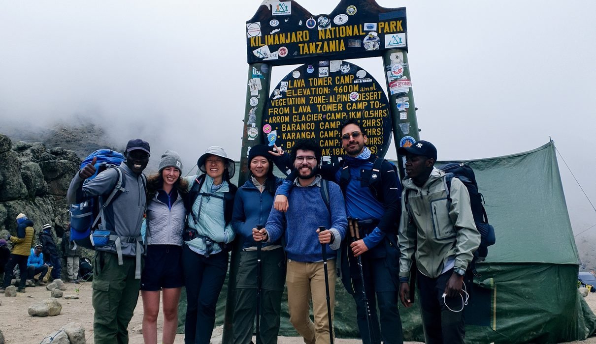
The Shira Route is one of the most scenic ways to climb Mount Kilimanjaro in Tanzania. Approaching the mountain from the west, this route takes climbers across the beautiful Shira Plateau, through open moorland and volcanic landscapes, and eventually toward Uhuru Peak, the highest point in Africa at 5,895 metres (19,341 feet). It is a good option for travelers who enjoy wide mountain views, quiet trekking trails, and the chance to see a different side of Kilimanjaro.
Unlike the Machame and Lemosho routes, the Shira Route begins at a relatively high elevation. Climbers travel by vehicle through the western entrance of Kilimanjaro National Park before reaching the Shira Plateau, where the walking adventure begins at approximately 3,400–3,600 metres above sea level. This saves some walking time through the lower forest, but it also means that the body has less time to adjust to the altitude during the early stages of the expedition.
For travelers planning to climb Kilimanjaro in 2027, 2028 or 2029, the Shira Route offers a combination of scenic landscapes, mountain camping, and challenging trekking. Along the way, you can explore the Shira Plateau, walk near Lava Tower, descend into Barranco Valley, cross the famous Barranco Wall, and continue toward Barafu Camp before making your summit attempt. Each stage brings a different view of the mountain, making the journey interesting from the first day to the final descent.
At Eddy Tours & Safaris, we help travelers plan Kilimanjaro climbing expeditions with suitable itineraries, mountain guides, camping arrangements, and practical advice before departure. This guide explains the Shira Route, its main attractions, an eight-day itinerary, climbing difficulty, altitude considerations, and what to expect when booking a Kilimanjaro adventure for 2027, 2028 or 2029.

Shira Route Kilimanjaro Climbing Overview
| Tour details | Information |
|---|---|
| Climbing route | Shira Route |
| Destination | Mount Kilimanjaro, Tanzania |
| Travel years | 2027, 2028 and 2029 |
| Featured itinerary | 8 days and 7 mountain nights |
| Starting area | Londorossi Gate and Shira Plateau |
| Finishing point | Mweka Gate |
| Highest elevation | Uhuru Peak, 5,895 metres |
| Difficulty | Challenging, with a high starting elevation |
| Accommodation | Mountain camping |
| Main attractions | Shira Plateau, Shira Cathedral, Lava Tower, Barranco Wall and Uhuru Peak |
| Summit approach | Barafu Camp via Stella Point |
| Descent | Mweka Route |
| Starting town | Moshi, Tanzania |
| Price | Available on request |
What Makes the Shira Route Special?
The Shira Route is different from several other Kilimanjaro routes because it begins high on the western side of the mountain. Rather than spending the first day walking through dense rainforest, climbers travel by vehicle to the Shira Plateau and begin trekking in an open landscape. This provides early views of the mountain’s volcanic terrain, with grasslands, rocky formations, and the broad summit of Kibo visible when the weather is clear.
One of the main attractions is the Shira Plateau itself. This large volcanic landscape is part of Kilimanjaro’s ancient geological history and offers a completely different environment from the lower forest. The walking trails cross open ground with wide views toward the mountain, while features such as Shira Cathedral provide interesting opportunities for photography and exploration.
The Shira Route eventually joins the southern circuit used by other Kilimanjaro routes, including Lemosho and Machame. Climbers then experience Lava Tower, Barranco Valley, Karanga Camp, and Barafu Camp before making the final ascent toward Uhuru Peak. This combination of open western landscapes and famous southern circuit landmarks makes Shira a rewarding option for travelers who are already comfortable with the demands of high-altitude trekking.
However, the high starting elevation is an important disadvantage for climbers arriving directly from low altitude. The route should be selected carefully, particularly by first-time climbers who have never experienced elevations above 3,000 metres. The Lemosho Route may be a more suitable alternative because it begins lower and allows a more gradual approach to the Shira Plateau.

Complete 8-Day Shira Route Kilimanjaro Itinerary
This eight-day itinerary includes an additional overnight stay near Moir Hut, providing more time on the mountain before reaching the southern circuit. The daily elevations, walking distances, and trekking times are approximate and should be confirmed against the final route plan and campsite arrangements.
Day 1: Moshi – Londorossi Gate – Shira Plateau – Shira 1 Camp
Starting elevation: Approximately 3,400 metres at the upper trailhead
Overnight elevation: Approximately 3,500–3,610 metres
Hiking distance: Approximately 4 km
Walking time: 1–3 hours
Accommodation: Shira 1 Camp
Your Kilimanjaro adventure begins in Moshi, where you meet your mountain guide and support team before traveling toward Londorossi Gate on the western side of the mountain. The drive passes through villages, farmland, and the green countryside surrounding Kilimanjaro. At the gate, your guides complete the required park registration procedures while the mountain crew organizes equipment, food supplies, and camping arrangements for the expedition.
After registration, you continue by vehicle toward the Shira Plateau, following the designated mountain access road. As the vehicle gains elevation, the landscape changes from forested slopes to more open highland terrain. The journey provides an early introduction to Kilimanjaro’s western side, with wide views across the surrounding countryside when the weather is clear.
The first trekking stage is relatively short, taking you across the plateau toward Shira 1 Camp. Although the walking distance is manageable, the high starting elevation should not be underestimated. You may notice that breathing feels different from walking at lower elevations, and your guide will encourage a slow pace while monitoring how everyone responds to the altitude.
Upon reaching camp, the mountain crew prepares the tents and evening meal. The remainder of the day is reserved for rest, allowing you to settle into the mountain environment. Because you are already sleeping at a high elevation on the first night, any headache, nausea, dizziness, or unusual fatigue should be reported immediately.
Meals: Lunch and dinner
Overnight: Shira 1 Camp

Day 2: Shira 1 Camp – Shira Cathedral – Shira 2 Camp
Starting elevation: Approximately 3,500–3,610 metres
Overnight elevation: Approximately 3,840–3,850 metres
Hiking distance: Approximately 6–8 km, depending on the selected trail
Walking time: 4–6 hours
Accommodation: Shira 2 Camp
After breakfast, you begin walking across the open Shira Plateau toward Shira 2 Camp. The landscape is characterized by grasslands, scattered alpine vegetation, and unusual volcanic rock formations. Unlike the forest trails found on other Kilimanjaro routes, the Shira Plateau offers wide views across the mountain, allowing you to appreciate the scale of the landscape.
Depending on the itinerary and weather conditions, your guide may include a visit toward Shira Cathedral, a striking volcanic rock formation on the plateau. The surrounding terrain provides interesting views of the western slopes and the distant summit of Kibo. The walking pace remains steady, with regular breaks for water, snacks, and photography.
Although the elevation gain is not as dramatic as on some later days, you are still walking at a considerable altitude. Your guide will monitor the group’s condition and encourage you to avoid unnecessary exertion. The day’s relatively moderate schedule provides an opportunity to become more comfortable with the mountain environment before continuing toward higher camps.
By afternoon, you arrive at Shira 2 Camp, where the mountain crew prepares the camping area and meals. The open surroundings offer views of the mountain when conditions are clear, while the colder evening temperatures remind you that the expedition is moving steadily toward the alpine zone.
Meals: Breakfast, lunch and dinner
Overnight: Shira 2 Camp
Day 3: Shira 2 Camp – Moir Hut Camp
Starting elevation: Approximately 3,840 metres
Overnight elevation: Approximately 4,200 metres
Hiking distance: Approximately 7–10 km
Walking time: 4–6 hours
Accommodation: Moir Hut Camp
After breakfast at Shira 2 Camp, you continue toward the Moir Hut area on the western side of Kibo. The trail gradually rises through increasingly rocky terrain, and the vegetation becomes noticeably thinner as you move into the alpine desert environment. The surrounding landscape is open and exposed, with views toward the upper mountain when the weather allows.
The journey toward Moir Hut provides an opportunity to explore a quieter part of Kilimanjaro. Compared with some of the more heavily used southern trails, this section may feel more remote, with broad volcanic landscapes and rocky ridges dominating the scenery. Your guide will maintain a slow walking pace and encourage regular breaks as the group continues gaining elevation.
Moir Hut Camp is situated at approximately 4,200 metres, making this an important stage of the expedition. Spending the night at this elevation requires careful attention to acclimatization, and the guide will assess how each climber is responding. An optional short walk may be considered if conditions and individual health permit, but rest is equally important.
After reaching camp, you can enjoy a warm meal and spend the afternoon preparing for the following day’s journey toward Lava Tower and Barranco Valley. The mountain environment becomes colder and more exposed at this elevation, so warm clothing and suitable sleeping equipment are particularly important.
Meals: Breakfast, lunch and dinner
Overnight: Moir Hut Camp
Day 4: Moir Hut – Lava Tower – Barranco Camp
Starting elevation: Approximately 4,200 metres
Highest point: Lava Tower, approximately 4,600–4,630 metres
Overnight elevation: Approximately 3,950–3,980 metres
Hiking distance: Approximately 8–11 km
Walking time: 6–8 hours
Accommodation: Barranco Camp
The fourth day takes you toward Lava Tower before descending into Barranco Valley. After breakfast, you leave Moir Hut and follow the trail across the rocky mountain landscape. The terrain becomes increasingly exposed, with limited vegetation and wide views of Kilimanjaro’s volcanic slopes.
As you approach Lava Tower, the trail reaches an elevation above 4,600 metres. Walking at this altitude can be physically demanding because of the reduced oxygen availability. Your guide will encourage a slow pace and monitor the group carefully, especially because symptoms of altitude illness can appear or worsen during this stage.
After reaching the Lava Tower area, you begin descending toward Barranco Camp. This stage allows you to spend time at a higher elevation during the day before sleeping lower in Barranco Valley. Such an elevation profile can support acclimatization, although it does not eliminate the risk of altitude sickness.
The descent introduces a change in scenery, including unusual high-altitude plants and steep volcanic formations. As you approach Barranco Camp, the famous Barranco Wall rises above the valley, creating one of the most recognizable views on Kilimanjaro. After dinner, your guide explains the following day’s climb across the wall and the journey toward Karanga Camp.
Meals: Breakfast, lunch and dinner
Overnight: Barranco Camp
Day 5: Barranco Camp – Barranco Wall – Karanga Camp
Starting elevation: Approximately 3,950–3,980 metres
Overnight elevation: Approximately 3,995–4,035 metres
Hiking distance: Approximately 5 km
Walking time: 4–5 hours
Accommodation: Karanga Camp
After breakfast, you leave Barranco Camp and begin climbing the famous Barranco Wall. This steep rocky section is one of Kilimanjaro’s best-known trekking challenges and involves careful scrambling, with climbers occasionally using their hands for balance. Although the route does not normally require technical climbing equipment, it demands attention, patience, and confidence when moving across uneven rock surfaces.
Your mountain guides will assist the group through the appropriate sections and encourage everyone to move carefully. Once you reach the top of the wall, the trail continues across a series of ridges and valleys, offering views toward Kibo and the surrounding mountain slopes when visibility is good.
The route then descends into Karanga Valley before climbing again toward Karanga Camp. Although the day’s walking distance is relatively short, the changing terrain requires steady effort. The additional overnight stop at Karanga provides time for rest before continuing toward Barafu, the summit base camp.
By afternoon, you arrive at Karanga Camp, where the support team prepares the camping area and meals. The remainder of the day can be spent resting, checking equipment, and discussing the final stages of the expedition with your guide.
Meals: Breakfast, lunch and dinner
Overnight: Karanga Camp
Day 6: Karanga Camp – Barafu Camp
Starting elevation: Approximately 3,995–4,035 metres
Overnight elevation: Approximately 4,640–4,673 metres
Hiking distance: Approximately 4 km
Walking time: 3–5 hours
Accommodation: Barafu Camp
After breakfast at Karanga Camp, you continue uphill toward Barafu Camp. The trail passes through exposed alpine desert, where rocky terrain and sparse vegetation dominate the landscape. The mountain becomes increasingly cold and windy as you gain elevation, and walking requires greater effort because of the reduced oxygen availability.
Although the trekking distance is relatively short, the ascent should be approached slowly. Your guide will maintain a controlled pace and encourage regular breaks, allowing the group to conserve energy before summit night. On clear days, the surrounding landscape provides views of Kibo, Mawenzi, and the mountain’s southern slopes.
Upon reaching Barafu Camp, the mountain crew prepares the tents and an early meal. Your guide will explain the summit-night arrangements, including the expected departure time, clothing requirements, walking pace, and safety procedures. You should prepare your insulated jacket, gloves, headlamp, water, and other essential items before attempting to rest.
The afternoon and evening are generally reserved for recovery because the summit ascent often begins around midnight. Sleeping at this elevation can be difficult, but avoiding unnecessary activity is important. Your guide will assess the group’s health before departure, and climbers experiencing concerning symptoms may need to change their plans rather than continue toward the summit.
Meals: Breakfast, lunch and dinner
Overnight: Barafu Camp
Day 7: Barafu Camp – Stella Point – Uhuru Peak – Mweka Camp
Starting elevation: Approximately 4,640–4,673 metres
Summit elevation: 5,895 metres
Overnight elevation: Approximately 3,080–3,100 metres
Hiking distance: Approximately 16–18 km
Walking time: 12–16 hours or longer
Accommodation: Mweka Camp
Summit day begins during the night, often around midnight, depending on the weather, group condition, and guide’s assessment. After preparing your warm clothing, gloves, headlamp, and essential supplies, you leave Barafu Camp and begin ascending the steep volcanic slopes toward Stella Point. The trail becomes increasingly rocky, with loose scree in places, while the cold nighttime conditions make the ascent particularly demanding.
At this elevation, even slow walking can require considerable effort. Your guide will maintain a steady pace and encourage regular short breaks while carefully monitoring the group’s health. The combination of darkness, freezing temperatures, fatigue, and high altitude makes this the most challenging stage of the expedition for many climbers.
After several hours of climbing, you approach Stella Point on the crater rim at approximately 5,756 metres. If your health and the weather permit, you continue along the rim toward Uhuru Peak, the highest point on Mount Kilimanjaro and the African continent. Reaching the summit provides an opportunity to appreciate the mountain’s high-altitude landscape and take photographs, although time at the top is normally limited because of the extreme conditions.
Following the summit attempt, you descend toward Barafu Camp, where you may have time to rest and eat before continuing down the Mweka Route. The descent is long and can be tiring, particularly after the demanding nighttime ascent. By evening, you reach Mweka Camp at a considerably lower elevation, where the support team prepares dinner and you spend your final night on the mountain.
Meals: Breakfast, lunch and dinner
Overnight: Mweka Camp
Day 8: Mweka Camp – Mweka Gate – Return to Moshi
Starting elevation: Approximately 3,080–3,100 metres
Finishing elevation: Approximately 1,640 metres
Hiking distance: Approximately 9–10 km
Walking time: 3–5 hours
Accommodation: Not included unless specified in your quotation
After breakfast at Mweka Camp, you begin the final descent through Kilimanjaro’s rainforest. The trail leads downhill through dense vegetation, with tall trees and a warmer, more humid environment replacing the rocky alpine landscape experienced during the previous day. Depending on the weather, some sections may be muddy or slippery, so it is important to continue walking carefully.
As you descend, the surrounding forest provides a noticeable contrast to the open Shira Plateau and the high-altitude terrain of the upper mountain. The final trekking stage offers time to reflect on the different landscapes experienced during the expedition, the challenges of summit night, and the support provided by your mountain crew.
Upon arrival at Mweka Gate, your guide completes the required exit procedures. Climbers who meet the applicable summit requirements may receive the appropriate climbing certificate through the park’s established process. Your driver then transfers you back to Moshi, where you can rest and prepare for your onward journey.
This marks the end of your eight-day Shira Route expedition. Depending on your travel arrangements, you may spend an additional night in Moshi, return home, or continue with a Tanzania wildlife safari or Zanzibar holiday organized through Eddy Tours & Safaris.
Meals: Breakfast and lunch, subject to confirmed arrangements
End of expedition: Moshi
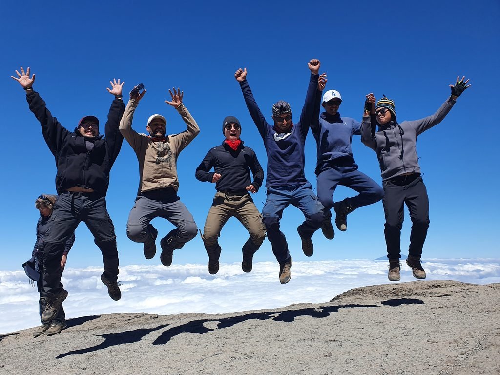
Shira Route 8-Day Itinerary Summary
| Day | Route | Overnight elevation |
|---|---|---|
| 1 | Londorossi Gate – Shira Plateau – Shira 1 Camp | 3,500–3,610 m |
| 2 | Shira 1 – Shira Cathedral area – Shira 2 | 3,840–3,850 m |
| 3 | Shira 2 – Moir Hut | 4,200 m |
| 4 | Moir Hut – Lava Tower – Barranco Camp | 3,950–3,980 m |
| 5 | Barranco – Barranco Wall – Karanga Camp | 3,995–4,035 m |
| 6 | Karanga – Barafu Camp | 4,640–4,673 m |
| 7 | Barafu – Stella Point – Uhuru Peak – Mweka Camp | 3,080–3,100 m |
| 8 | Mweka Camp – Mweka Gate – Moshi | End of climb |
How Difficult Is the Shira Route?
The Shira Route is a challenging high-altitude trek that requires good physical endurance, suitable preparation, and careful acclimatization. Although the standard route does not normally require technical mountaineering experience, climbers must manage rocky terrain, changing weather conditions, long walking days, and the effects of reduced oxygen availability.
One of the biggest challenges is the high starting elevation. Unlike Lemosho, which begins lower and allows climbers to walk gradually toward the Shira Plateau, Shira starts at approximately 3,400–3,600 metres. This can make the first night particularly demanding for travelers who have recently arrived from sea level.
For this reason, the Shira Route is often more appropriate for climbers who have previous high-altitude experience or have already spent time acclimatizing before the expedition. Travelers who are new to high-altitude trekking should consider a lower-starting route with a more gradual ascent.
Shira Route vs Lemosho Route: Which Is Better?
Shira and Lemosho approach Kilimanjaro from the west and share much of the same upper mountain itinerary. Both routes can include the Shira Plateau, Lava Tower, Barranco Wall, Karanga Camp, Barafu Camp, and the final ascent toward Uhuru Peak.
The main difference is the starting elevation. Lemosho begins at a lower altitude and usually includes a rainforest trekking stage before reaching the Shira Plateau. This provides a more gradual introduction to the mountain and can be helpful for climbers who have not previously spent time at high elevation.
Shira begins much higher, allowing travelers to reach the plateau quickly but reducing the time available for early acclimatization. For many first-time climbers, an eight-day Lemosho itinerary is generally preferable, while Shira may appeal to experienced hikers who understand the implications of the higher starting point.
| Feature | Shira Route | Lemosho Route |
|---|---|---|
| Starting elevation | Approximately 3,400–3,600 m | Approximately 2,100–2,400 m |
| Initial landscape | Open plateau and moorland | Rainforest |
| High-altitude exposure | Begins immediately | More gradual |
| Main upper route | Southern circuit | Southern circuit |
| Accommodation | Camping | Camping |
| General suitability | Better for suitably acclimatized trekkers | Often preferable for first-time climbers |
What Is the Summit Success Rate of the Shira Route?
The summit success rate of the Shira Route varies between operators, climbing groups, seasons, and itinerary durations. Some websites advertise high success percentages, but these figures should be supported by actual expedition records rather than treated as universal statistics.
The eight-day itinerary provides additional time on the mountain compared with shorter Shira climbs, but the high starting elevation remains an important consideration. Even physically fit climbers can develop altitude illness when ascending rapidly, and an additional day does not guarantee successful acclimatization.
For 2027, 2028, and 2029, future summit success statistics cannot yet be calculated. Travelers should request documented historical records from their chosen operator and avoid relying on guaranteed summit percentages.

Best Time to Climb the Shira Route in 2027, 2028 and 2029
Mount Kilimanjaro can be climbed throughout the year, although weather conditions vary by season. January to March and June to October are commonly popular climbing periods because they often experience relatively drier weather. However, conditions can change quickly at high altitude, and even during popular months, climbers may encounter rain, strong winds, freezing temperatures, or poor visibility.
April and May are generally associated with heavier rainfall, which can make trails wet and slippery. November and December may also experience seasonal rainfall, although conditions vary between years. Travelers should choose their departure dates according to their availability and preferred conditions rather than expecting any particular month to guarantee clear skies.
For 2027, 2028, and 2029, it is advisable to discuss your preferred dates with Eddy Tours & Safaris before arranging international flights. Exact departure availability, park fees, and package prices should be confirmed through a written quotation.
What Is Included in a Shira Route Kilimanjaro Package?
The exact services included in a Shira Route package depend on the confirmed quotation. A professionally organized Kilimanjaro expedition commonly includes the required national park entry and camping fees, authorized mountain guides, porters, a mountain cook, camping equipment, meals during the climb, and transport between Moshi and the park gates.
The mountain crew normally transports the main camping equipment and food supplies while climbers carry their personal daypacks. Group camping arrangements may include sleeping tents, cooking facilities, and dining equipment, depending on the selected package. Your operator should also explain the health monitoring procedures and emergency arrangements before the expedition begins.
Services commonly excluded unless specifically stated include international flights, Tanzania visa fees, travel insurance, personal hiking clothing and equipment, tips for the mountain crew, equipment rental, and hotel accommodation before or after the climb. Optional Tanzania safari and Zanzibar holiday arrangements are normally quoted separately.
Essential Packing List for the Shira Route
Climbers need suitable clothing and equipment for cold mountain conditions because the Shira Route begins at a relatively high elevation. Unlike routes that start in the rainforest, the first day may already involve cool temperatures, strong winds, and exposed terrain. Warm clothing should therefore be accessible from the beginning of the expedition.
Recommended equipment includes waterproof hiking boots, moisture-wicking shirts, thermal base layers, trekking trousers, a warm fleece or insulated mid-layer, a substantial insulated jacket, waterproof outerwear, warm gloves, a hat, sunglasses, and a reliable headlamp. Trekking poles are useful during steep descents and on loose volcanic terrain, while a comfortable daypack allows you to carry water, snacks, rain protection, and essential personal supplies.
A suitable cold-weather sleeping bag is also important because mountain nights can be freezing. Test your boots and clothing before departure, and request a detailed packing list from your tour operator to ensure that your equipment is appropriate for the planned travel dates.
Physical Preparation for the Shira Route
Preparing for the Shira Route should focus on building endurance, strengthening the legs, and becoming comfortable with several consecutive days of walking. Regular hill hiking, stair climbing, cardiovascular exercise, and strength training can help prepare your body for the demands of Kilimanjaro. Training on uneven terrain is especially useful because the route includes rocky trails, exposed mountain sections, and long downhill stages.
For many first-time climbers, three to six months of consistent preparation is a useful starting point, although the exact training period depends on current fitness and hiking experience. Gradually increasing walking distance and elevation gain is generally more sensible than attempting very demanding workouts without adequate recovery.
However, physical fitness does not prevent altitude sickness. Even highly trained climbers can experience serious symptoms when ascending too quickly. For this reason, route selection, acclimatization time, and honest communication with your mountain guide remain essential parts of preparation.
Altitude Sickness and Safety on the Shira Route
Altitude sickness is one of the main risks associated with climbing Kilimanjaro, and it deserves particular attention on the Shira Route because of the high starting elevation. Symptoms may include headache, nausea, dizziness, unusual tiredness, poor appetite, and difficulty sleeping. More serious warning signs can include confusion, loss of coordination, or breathlessness at rest, which require urgent medical attention and may indicate a need for immediate descent.
The Shira Route includes opportunities for acclimatization, particularly on longer itineraries that incorporate additional overnight stops. However, beginning the expedition at approximately 3,400–3,600 metres can be challenging for travelers arriving directly from low altitude. Climbers should report symptoms immediately and should never continue ascending with worsening altitude illness.
Before traveling, consult a qualified healthcare professional about high-altitude trekking, particularly if you have an existing medical condition or previous altitude-related symptoms. Appropriate travel insurance should cover high-altitude trekking and emergency evacuation. On the mountain, your guide’s health assessments and safety decisions must always take priority over the planned summit attempt.
Combine Your Shira Route Climb with a Tanzania Safari
Many travelers choose to combine their Kilimanjaro expedition with a wildlife safari in northern Tanzania. After completing the Shira Route, you can explore destinations such as Tarangire National Park, Serengeti National Park, Ngorongoro Crater, and Lake Manyara National Park. This provides an opportunity to experience Tanzania’s mountain landscapes and wildlife areas during the same holiday.
A three- to five-day safari can be a practical addition for travelers who have limited time, while longer itineraries provide more opportunities to explore several parks. Some visitors also choose to continue to Zanzibar for a beach holiday after their mountain and safari experiences.
It is important to allow suitable recovery time after the climb, especially if you experienced significant exhaustion, injury, or altitude-related symptoms. Your onward travel arrangements should be planned according to your health and overall schedule.
Frequently Asked Questions About the Shira Route
1. What is the Shira Route on Kilimanjaro?
The Shira Route is a western approach to Mount Kilimanjaro that begins at a relatively high elevation on the Shira Plateau.
2. How many days does the Shira Route take?
Common itineraries take approximately seven or eight days, although shorter versions are also offered.
3. Is the Shira Route suitable for beginners?
It is generally less suitable for first-time high-altitude climbers because of its high starting elevation.
4. What is the highest point of the Shira Route?
Uhuru Peak, at 5,895 metres above sea level.
5. Where does the Shira Route begin?
The route begins on the western side of Kilimanjaro, with access through Londorossi Gate and the Shira Plateau.
6. Where does the Shira Route finish?
Climbers normally descend through Mweka Camp and finish at Mweka Gate.
7. Is Shira the same as Lemosho?
No. The routes share much of the upper mountain itinerary, but Lemosho begins at a lower elevation.
8. Why is the Shira Route challenging?
The high starting elevation provides limited time for early acclimatization.
9. Does the Shira Route include Barranco Wall?
Yes. The standard southern circuit itinerary includes the Barranco Wall.
10. Does Shira include Lava Tower?
Yes. Many Shira itineraries pass through the Lava Tower area before descending toward Barranco Camp.
11. What is Shira Cathedral?
Shira Cathedral is a striking volcanic rock formation on the Shira Plateau.
12. Where do climbers sleep?
Climbers sleep in tents at designated mountain campsites.
13. Does the Shira Route require technical climbing?
Technical mountaineering experience is not normally required on the standard route.
14. What is the Shira Route summit success rate?
There is no single independently verified percentage that applies to every operator or departure.
15. Is eight-day Shira better than seven-day Shira?
The eight-day version can provide additional acclimatization time, depending on the itinerary.
16. How cold does the Shira Route get?
Temperatures can fall below freezing at higher elevations, particularly during the night.
17. How difficult is summit day?
Summit day is physically demanding because of the altitude, cold, darkness, and long descent.
18. Can fitness prevent altitude sickness?
No. Physical fitness improves endurance but does not guarantee successful acclimatization.
19. What is the best time to climb Shira?
January to March and June to October are generally popular climbing periods.
20. Can I climb the Shira Route during the rainy season?
Yes, but wet conditions can make the expedition less comfortable.
21. Do I need a mountain guide?
Yes. Kilimanjaro climbs require appropriate authorized guiding arrangements.
22. Can I rent hiking equipment in Moshi?
Some equipment may be available for rental, subject to supplier availability.
23. Can I book the Shira Route for 2027?
You can request a quotation and discuss suitable travel dates for 2027, subject to confirmation.
24. Can I book the Shira Route for 2028 or 2029?
You can enquire about future arrangements, although prices and availability must be confirmed.
25. Can I combine the Shira Route with a Serengeti safari?
Yes. A wildlife safari can be arranged after the climb, allowing suitable recovery time.
Book Your Shira Route Kilimanjaro Climb for 2027, 2028 or 2029
The Shira Route offers a scenic journey across Kilimanjaro’s western landscapes, from the open Shira Plateau to Lava Tower, Barranco Valley, Karanga Camp, and the final ascent toward Uhuru Peak. It is a rewarding choice for travelers who enjoy mountain scenery, quiet trekking sections, and a challenging high-altitude adventure.
However, the high starting elevation should be considered carefully. Travelers who have not previously spent time at altitude may find a lower-starting route such as Lemosho more suitable. Choosing an appropriate itinerary, preparing physically, and understanding the risks of altitude illness are important steps before attempting the climb.
At Eddy Tours & Safaris, we help travelers organize guided Kilimanjaro expeditions for 2027, 2028 and 2029. Our team can discuss Shira Route options, compare alternative climbing itineraries, explain preparation requirements, and provide a detailed quotation based on your preferred dates and group size.
Request Your Shira Route Kilimanjaro Quotation
Chat with Eddy Tours & Safaris on WhatsApp
Email: sales@eddytours-safaris.com
Contact our team to plan your Kilimanjaro expedition with a suitable climbing route, realistic expectations, and mountain safety as the priority.